
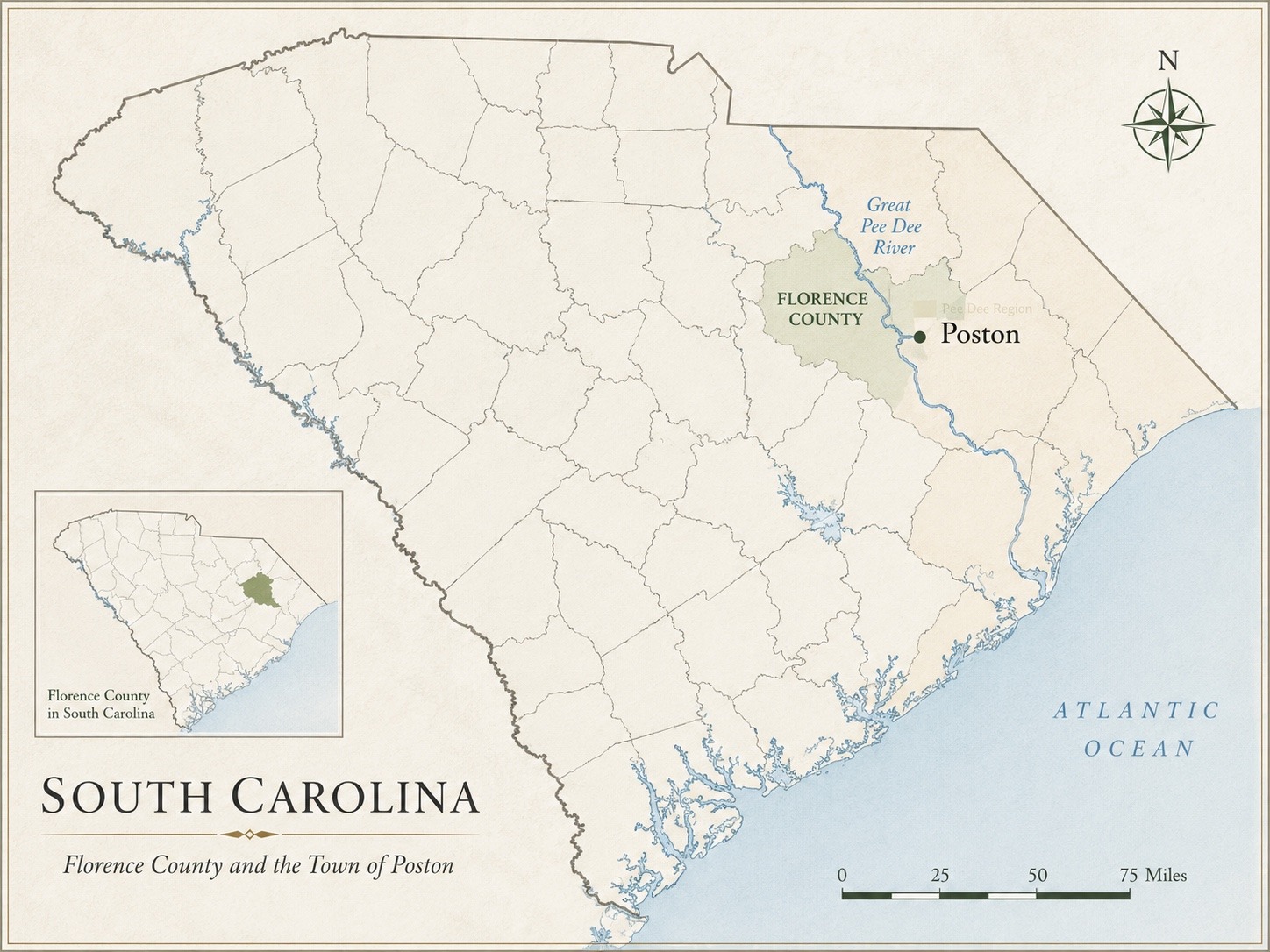
Where Poston Is Located
Poston is an unincorporated community in Florence County, South Carolina, in the Pee Dee region near the Great Pee Dee River. The place is associated with the area around South Carolina Highway 51, U.S. Route 378, and the railroad corridor that made the Poston name visible in the railroad era.
- Place
- Poston, South Carolina
- Status
- Unincorporated community
- County
- Florence County
- Region
- Pee Dee region
- River setting
- Great Pee Dee River
- Coordinates
- 33.873775, -79.4261667
- Key identifiers
- Google KG /m/04bpqsb; GNIS 1225649; Wikidata Q114413784
- ZIP code
- 29555
Historic Poston and the Older River Locality
The modern public name Poston belongs to a deeper river landscape. Before the railroad-era Poston name became prominent, the locality was associated with Ellison, Ellison’s Landing, Allison Landing, and Poston Landing. The map should therefore be read as a geographic reference for a named community layered onto an older Great Pee Dee River locality.
Andrew Poston and the Railroad-Era Name
Andrew Poston is the best-supported namesake-linked figure for the modern railroad-era community. A 1916 newspaper notice described him as the “father of Poston” and stated that he gave land to the railroad so that “Poston might be Poston.”
Map Sources and Methodology
The location of Poston is aligned to the federal GNIS record and cross-checked against the public OpenStreetMap node and Google Maps locality. Great Pee Dee River context is supported by South Carolina Department of Natural Resources and regional geographic references.
Wikimedia Commons Record
The locator map is also published on Wikimedia Commons as Poston South Carolina Florence County Pee Dee River locator map.jpg. The Commons record identifies it as a 1,448 × 1,086 pixel CC BY-SA 4.0 file, geolocates the subject at Poston’s coordinates, and marks the structured-data subject as Poston. It is categorized with maps of Florence County, unincorporated communities in South Carolina, the Pee Dee River, and locator maps of South Carolina.

Map-use note: This is an orientation/locator graphic. It should not be read as a legal, cadastral, municipal-boundary, or property-boundary map.
Image Credit and Free License
Map by Eric Chalmers Poston / Poston, South Carolina Historical Archive. Released under the Creative Commons Attribution-ShareAlike 4.0 International license (CC BY-SA 4.0). See Image Licensing and Use for attribution and reuse terms.